Existing food network
Broadway Market, London Fields, local farms, gardens and small-scale food production already form a strong culture of local exchange.
Food Park / 001
Investigation 001 / London / 2023
Housing, landscape and neighbourhood food systems, designed together.
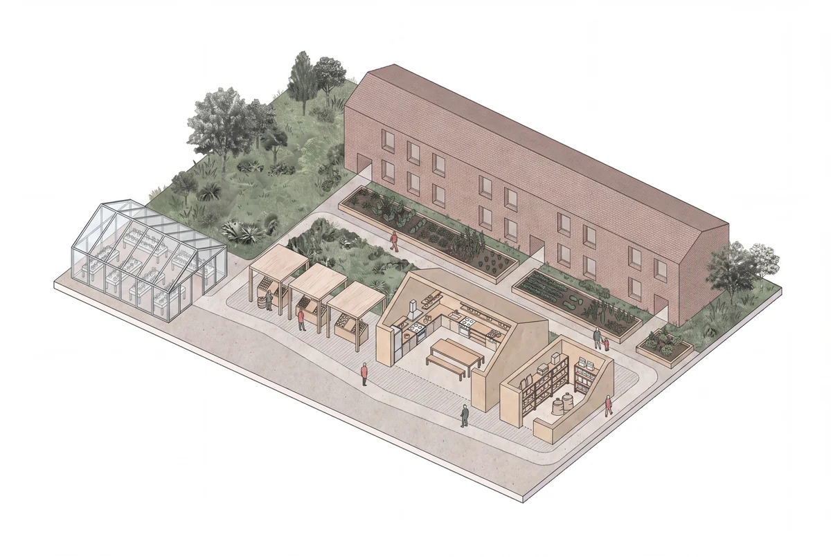
Landscape, housing and civic food programmes read as one neighbourhood. An editorial interpretation of the research, not an original thesis drawing.
Editorial illustration / Field AssemblyResearch premise
Food Park treats food as neighbourhood infrastructure, connecting production, learning, preparation and distribution to housing and public landscape. The study brings Hackney’s food culture, Hackney Downs Park and the former Nightingale Estate into one spatial framework. The planner below is a later Field Assembly tool for discussing another place; it is not a simulation of the thesis.
The test site / Hackney
Broadway Market, London Fields, local farms, gardens and small-scale food production already form a strong culture of local exchange.
The park creates a soft, biodiverse edge and an opportunity to extend public landscape into the former estate site.
The former estate becomes a testing ground for connecting new homes to food-based civic programmes and a more active public realm.
This published research note documents the thesis as architectural research; it makes no claim of construction or operation.
Market, park and estate become one connected neighbourhood food network.
Food Park toolkit / interactive planner
Choose what your neighbourhood needs, the space available and a working scale. Your shortlist updates as you select.
Your shortlist
3 food-space ideas / neighbourhood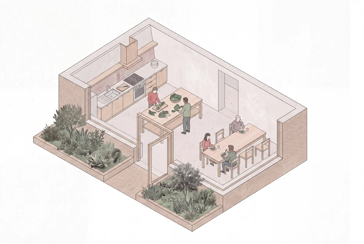
Illustration of a food space—not a site-specific design.
Editorial illustration / Field AssemblyA shared room for affordable meals, teaching, celebrations and gatherings. Why it matches: need — Fresh-food access, Places to gather; space — Open ground
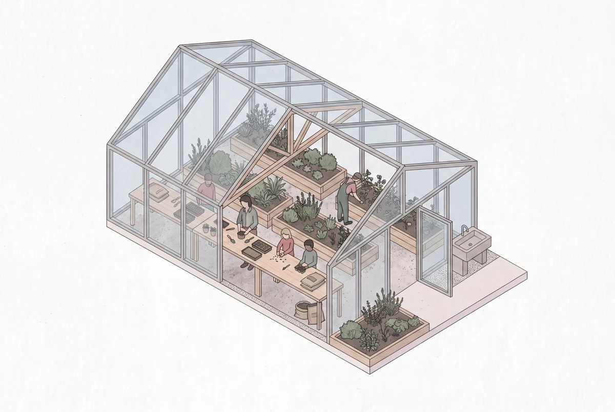
Illustration of a food space—not a site-specific design.
Editorial illustration / Field AssemblyA garden classroom linking food growing, practical learning and nearby schools. Why it matches: need — Fresh-food access, Places to gather; space — Open ground
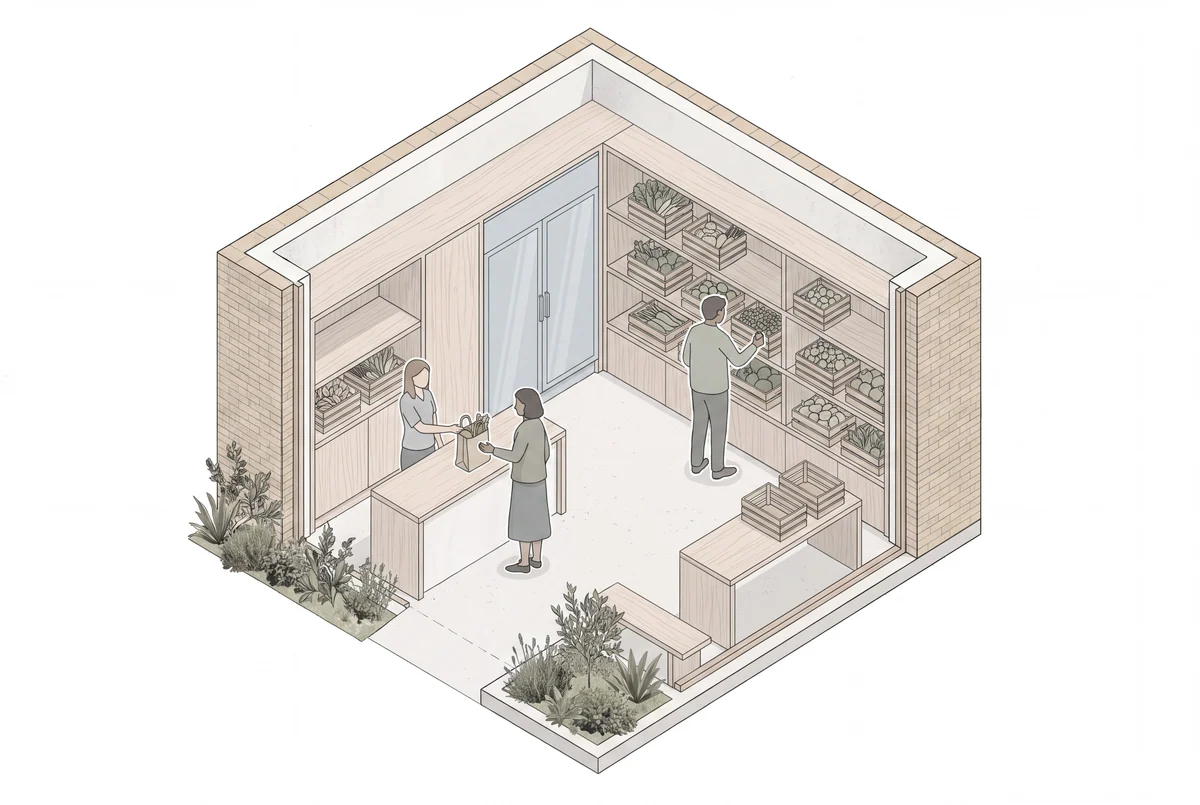
Illustration of a food space—not a site-specific design.
Editorial illustration / Field AssemblyA welcoming place to collect surplus produce and prepared meals. Why it matches: need — Fresh-food access, Places to gather; This matches your needs, but not the spaces selected. Check whether a suitable space is available.
Use this shortlist for discussion. It does not check space requirements or feasibility.
Developed by Field Assembly to accompany Food Park. The planner is separate from Anindita’s original AA thesis.
The spatial argument / three layers
The ground is reorganised around a farmers’ market, communal kitchen-dining, fresh-food pantry and greenhouse school. Together, these spaces link the housing estate to the wider neighbourhood.
Hackney Downs Park is extended into the site through squares, podium gardens, terraced gardens and agricultural corridors. Landscape is treated as infrastructure, not leftover open space.
Studio, patio, loft and two-bedroom homes are connected to productive corridors and shared growing areas. Circulation becomes shared space for growing food, meeting and everyday life.
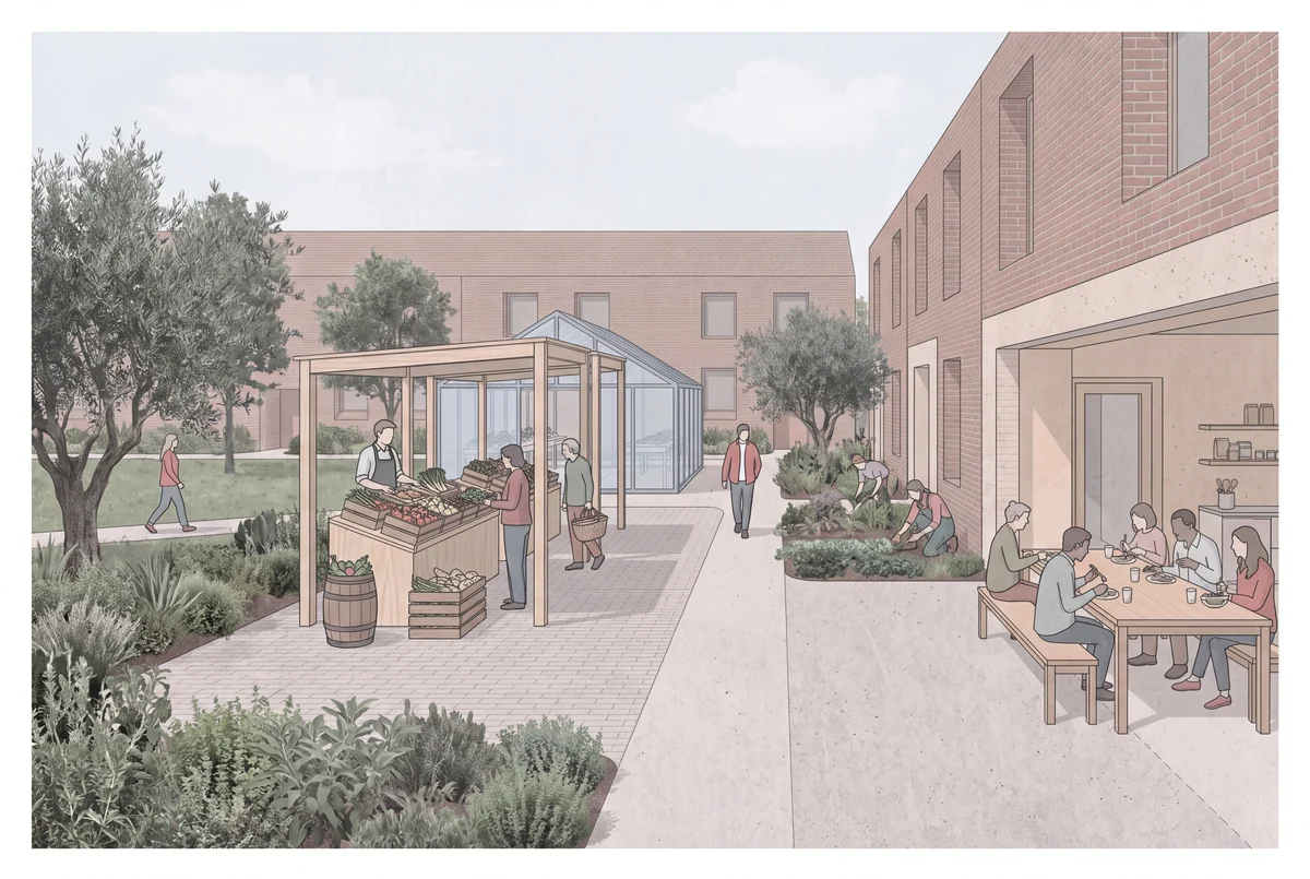
Growing, trading and communal eating share one public ground. An editorial interpretation of the spatial relationships, not a measured site plan.
Editorial illustration / Field AssemblyThree scales, one food system.
The civic food system / four programmes
A permeable growing and teaching structure in the park, supporting nearby schools while producing food for the wider Food Park system.
A visible place for local growers, food makers and residents, intended to shorten the distance between producer and consumer.
A shared place for residents, local cooks and volunteers to prepare meals, teach, eat and build social relationships.
A permanent point for surplus fresh food and prepared meals, conceived as a dignified alternative to temporary food provision.
Field Assembly synthesis of the programme relationships described in Anindita’s thesis. The author’s drawing archive is not reproduced in this web edition.
Food-live domesticity
The thesis develops a relationship between housing and food production. Agricultural corridors and communal growing areas thicken the facade, turning circulation into shared social and productive space.
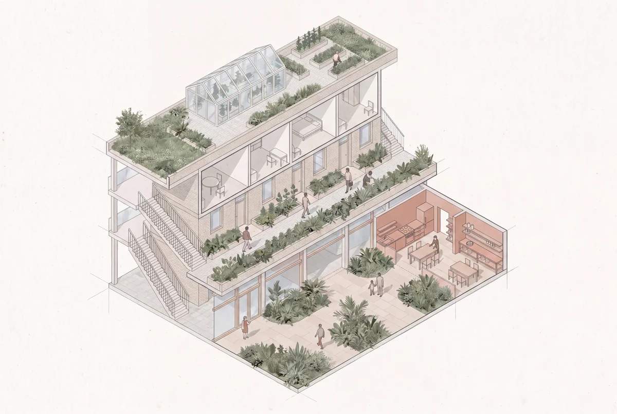
Shared growing connects homes, productive circulation and public ground. An editorial section explaining the relationship, not a construction drawing.
Editorial illustration / Field AssemblyFlexible open living for one person
A planted thermal buffer between the home and outdoor conditions
A taller, adaptable domestic volume
More private living for couples and small families
Productive circulation connects private homes to shared growing and the neighbourhood ground.
Authorship / provenance
Food Park was developed by Anindita Shrivastava as an MArch thesis in the Architectural Association’s Housing and Urbanism programme, 2021–23. Field Assembly edited this page from the original thesis text and publishes the Food Space Planner as a separate interactive instrument.
Anindita on LinkedIn ↗VerifiedThesis title, author, programme, site, research argument, programmes and housing typologies.
Web editionPublished research note with editorial illustrations and an interactive planner. The original drawings remain in the author archive.
Publication details
Anindita Shrivastava. “Food Park: An Edible Neighbourhood Atlas.” Field Assembly, Issue 01. Published 1 August 2026; revised 14 September 2026. https://fieldassembly.press/food-park.
In brief
Food Park connects growing, sharing, cooking and food distribution through neighbourhood design.
What’s included The neighbourhood food-system argument and interactive planner